Diriá National Park: Dry Forest & Trails in Guanacaste
Diriá National Park protects one of Guanacaste’s most ecologically varied landscapes — a sweep of tropical dry forest, transitional woodland, and cloud-forest pockets that rise from the lowlands of the Nicoya Peninsula to mist-touched ridgelines near Santa Cruz.
 Covering approximately 5,425 hectares (about 13,400 acres), the park began life as the Diriá National Forest Wildlife Refuge and was elevated to full national-park status in 2004. That upgrade acknowledged what local communities had long understood: this fragment of rare dry forest, fed by the watersheds of the Río Diriá, Río Enmedio, and Río Tigre, is irreplaceable. The park sits within the ecotourism and nature heartland of Guanacaste, yet it sees far fewer visitors than the region’s coastal draw cards — making it a genuine off-the-beaten-path destination.
Forest Ecosystems Along an Elevation Gradient
The park’s terrain climbs from roughly 140 metres above sea level at the lowland entrance to around 960 metres in the upper ridges. That gradient packs two distinct forest types into a relatively compact area.
 At lower elevations, tropical dry forest dominates — a globally threatened biome that loses much of its canopy during the November-to-April dry season, revealing dramatic bare silhouettes before bursting back to life with the rains. Costa Rica holds some of the last intact stretches of Pacific dry forest in Mesoamerica, and Diriá is a key piece of that puzzle.
Above 700 metres, the character of the forest shifts entirely. Moisture captured from Pacific clouds sustains an evergreen zone draped in mosses and giant bromeliads. Tree ferns and orchids appear. Temperatures drop. This transitional cloud-forest belt is the park’s most biodiverse zone and the one visitors most often describe as unexpectedly lush given Guanacaste’s sun-scorched reputation.
Hiking Trails and Natural Attractions
Two marked trails provide the primary visitor experience inside Diriá.
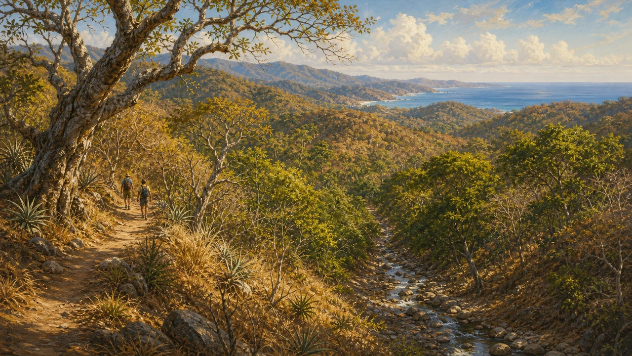
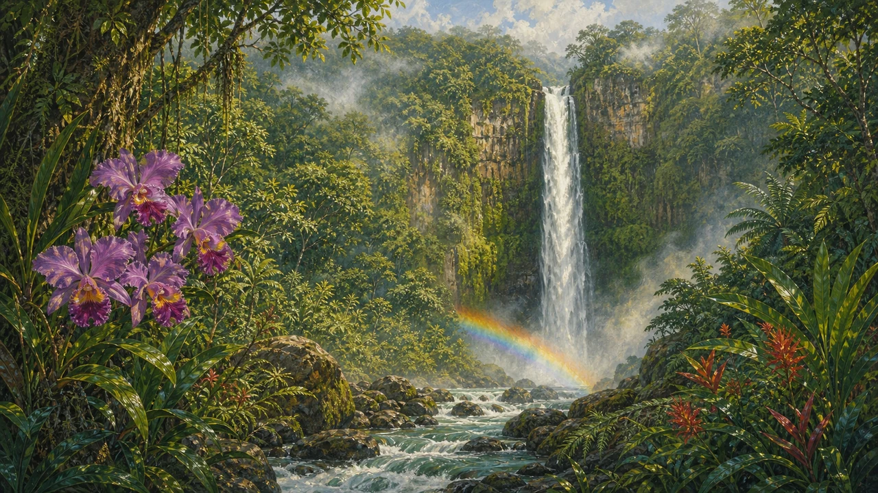
El Venado and El Escabel wind through the forest understory, crossing seasonal streams and offering viewpoints back toward the Nicoya lowlands. Both trails lead toward the Brasil waterfall, a rewarding destination that rewards the moderate climb through dry-forest terrain. Outside the driest weeks of the dry season, the waterfall runs well and makes a natural focal point for a half-day hike.
 Trail distances are manageable for fit walkers of any age, though the surface becomes uneven on steeper sections. Sturdy footwear, water, and sun protection are essential — shade thins quickly on south-facing slopes during the dry season. Rangers at the Sector Diriá station can advise on current trail conditions and point out recent wildlife sightings before you set off.
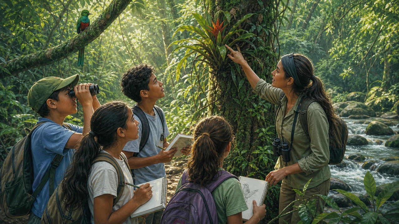
Beyond the waterfalls, patient hikers are rewarded by wildlife encounters. Howler monkeys are heard before they are seen in the early morning. White-tailed deer, coatis, and anteaters move through the undergrowth. The upper forest draws neotropical bird species that are absent from the coast, making the elevation gain worthwhile for birders.
Watershed Protection: The Park’s Core Mission
Diriá’s designation as a national park is rooted in water. The park protects the hydrographic basin system that feeds communities around Santa Cruz and surrounding villages. The Río Diriá, Río Enmedio, and Río Tigre originate in the upper forest, and maintaining intact forest cover at those elevations is what keeps those rivers running through the dry season.
 Costa Rica dedicates over 25 percent of its national territory to protected areas — a remarkable commitment that has reversed decades of deforestation and helped the country recover more than half its forest cover since the 1980s. Diriá sits within that system as a quiet but vital node, buffering Nicoya Peninsula communities from the worst effects of seasonal drought while sheltering biodiversity that cannot survive in surrounding agricultural land.
Research groups and university students regularly use the park’s facilities to study dry-forest ecology and hydrology — a reminder that Diriá functions as both a recreation destination and an open-air laboratory.
Getting There
The park entrance at Sector Diriá lies approximately 9 km south of Santa Cruz on the Nicoya Peninsula. The most straightforward route from the Central Valley:
- From San José, take the Interamerican Highway north to Liberia.
- At Liberia, turn west toward Santa Cruz (about 55 km).
- From Santa Cruz, head south; signage leads to the park entrance.
Travelers flying into Daniel Oduber International Airport (LIR) in Liberia can reach Santa Cruz in under an hour, making Diriá a realistic day-trip add-on to a broader Guanacaste itinerary. A rental car or private transfer is the practical choice — public buses serve Santa Cruz, but the final stretch to the park requires onward transport.
Park Facilities and Visitor Information
The ranger station at Sector Diriá is open daily from 8 a.m. to 4 p.m. Staff can answer questions, collect entrance fees (check current rates with SINAC, the national parks service), and orient first-time visitors to the trail system.
Overnight stays are possible in the park bunkhouse, which accommodates around 25 people and provides drinking water and generator power. Separate study and laboratory rooms are available for research groups by arrangement. Neither camping infrastructure nor a restaurant is available on site, so day visitors should bring all food and water from Santa Cruz.
For a broader national parks trip in the region, Diriá pairs naturally with Palo Verde National Park to the north (a Ramsar wetland) and the beaches of the Nicoya Peninsula to the west. Check Costa Rica travel tips for general planning advice, including road conditions during the rainy season, which runs roughly May through November.
Best Time to Visit
Diriá can be visited year-round, but the experience differs markedly by season.
Dry season (December–April): Trails are easier to navigate and the skeletal dry forest has a dramatic visual quality. Wildlife congregates near water sources, making sightings more predictable. The Brasil waterfall may slow to a trickle by March or April.
Rainy season (May–November): The forest transforms. Everything greens up rapidly, waterfalls run strong, and the upper cloud-forest zone is at its most lush. Trails can be muddy, and river crossings require care after heavy rain. This is also the best period for birdwatching as migratory species pass through and resident birds are most active.
Whatever the season, early morning arrival — before 9 a.m. — gives you the coolest temperatures, the loudest howler-monkey chorus, and the greatest chance of wildlife on the trail.
Frequently asked questions
Where is Diriá National Park located?
The park sits in Guanacaste Province, roughly 9 km south of Santa Cruz on the Nicoya Peninsula. From Liberia or San José, take the Interamerican Highway to Santa Cruz and follow signs south toward the park entrance.
What trails are inside Diriá National Park?
The park has two main hiking trails: El Venado and El Escabel. Both pass through dry and transitional forest and lead toward natural highlights including the Brasil waterfall. Trail conditions vary by season, so ask rangers about current accessibility.
What kind of forest does Diriá National Park protect?
The park spans an elevation gradient from about 140 to 960 metres above sea level. Lower slopes support tropical dry forest, a rare and threatened ecosystem. Above roughly 700 metres, the vegetation transitions to evergreen cloud forest with mosses and large bromeliads.
What wildlife can I expect to see at Diriá National Park?
The park shelters howler monkeys, white-tailed deer, coatis, and a variety of birds typical of Guanacaste's dry-forest corridor. The upper cloud-forest zone attracts species not found in the lowlands, making the elevation change itself a birding reward.
What facilities does the park offer for overnight visitors?
The Sector Diriá ranger station is open daily. The park has a bunkhouse with capacity for around 25 people, drinking water, a generator for electricity, and study rooms available for research groups. Confirm current availability and reservation procedures with SINAC before your visit.